
Qualified sites. Better early decisions.
InQI gives architecture and design teams a shared property foundation from day one — site constraints, code context, early cost and concept options, all connected to the address. Less time rebuilding information. More time designing.
The Problem
Architects research 4–6 sources manually before a single line is drawn.
One address. InQI handles the rest.
Your current reality —
3–4 hrs lost
average pre-design research time per project
4–6 tabs open
manually checked per feasibility study
$0 billed
until the research is done and the client says yes
Feasibility research in three steps.
From address to client-ready package — without opening a single external tab.
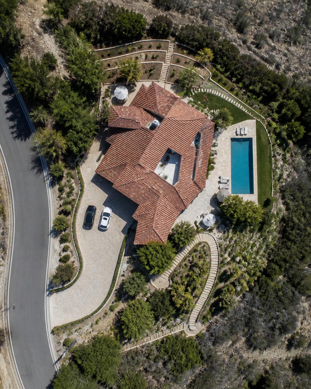 88' × 85'Parcel boundary
Lot size
7,480 sf
Zoning
R-1
Structures
2 found
Watch how architects use InQI.
One foundation. Every discipline uses it.
The site plan is the starting point. Every downstream tool — codes, estimates, concepts, and project binders — uses the same address foundation.
Site Plan
Scaled parcel geometry from any US address.
Codes.IQ
Address-specific code and zoning context.
Estimate.IQ
Rough cost ranges for early decisions.
Concept
Generated concepts tied to real constraints.
Binder
Every file and answer, organized by address.
One address. Six tools.
Everything you need for pre-design research — built into a single platform.
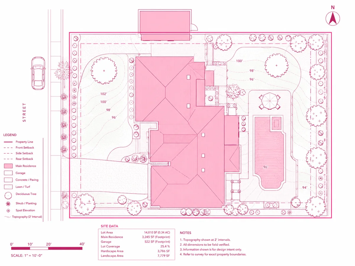
Scaled. Data-backed. CAD-ready.
Generate a scaled site plan for any US address in minutes. Parcel boundaries, setbacks, existing structures — pulled from real property data. Export to DXF, PDF, or SVG straight into your workflow.
One address. Six tools.
Everything you need for pre-design research — built into a single platform.
Scaled. Data-backed. CAD-ready.
Generate a scaled site plan for any US address in minutes. Parcel boundaries, setbacks, existing structures — pulled from real property data. Export to DXF, PDF, or SVG straight into your workflow.
Palo Alto, CA — R-1
Local codes. For that address. Automatically.
Stop digging through municipal websites. InQI checks building codes, zoning use, setbacks, and FAR for the specific property — jurisdiction-aware, always current.
Estimate range
$412k – $486k
Set realistic expectations before design starts.
Get rough cost ranges for the project scope early — before your client asks. Anchor conversations, validate feasibility, avoid scope surprises later.
110 University Dr — Binder
6 filesEvery file. One address. Always findable.
Your site plan, codes report, cost estimate, CAD exports, and field photos all land in the project Binder automatically — organized by address, referenceable by InQuest.
InQuest
Binder context onAsk anything about the project. It knows.
InQuest reads everything in your Binder and answers project-specific questions instantly. “What’s the max FAR for this lot?” “What did the cost estimate say for framing?” It already has the context.
Project detectedExisting conditions. Documented on-site.
Capture photos GPS-tagged and synced to the project Binder automatically. No camera roll chaos, no manual filing.
HOW ARCHITECTS USE IT
Built for every stage of early design.
From the first client call to permit prep — InQI fits where the work already happens.
Early Feasibility
01Run any address before the first client meeting.
Client calls about a property. Before you commit time or propose a fee — run the address, get the site plan, check the codes, see the cost range. Decide in minutes whether the project is viable.
Schematic Design
02Design from real parcel data, not assumptions.
Start design with real parcel data. Setbacks, FAR, lot coverage limits — already in front of you. No assumptions, no surprises when you submit.
Permit Preparation
03Package everything permit reviewers ask for.
Export the scaled site plan, attach the codes report, package the documents in the Binder. Everything permit reviewers ask for — organized under the address.
Existing Conditions
04Capture GPS-tagged photos on-site.
Use the mobile app on-site. GPS-tagged photos of existing structures, utilities, site conditions — synced to the project Binder before you leave the property.
Client Presentations
05Show up to the first meeting fully prepared.
Walk into the first meeting with a site plan, cost reality check, and code constraints already documented. Clients see you came prepared. Scope conversations start grounded.
THE DIFFERENCE
Same project.
Two very different experiences.
WITH INQI
- Codes checked before submission. Comments avoided.
- Parcel data pulled in seconds
- Codes surfaced for that address, that jurisdiction
- Every file under the address — always there
- Cost ranges ready before the client asks
- Site photos GPS-tagged and in the Binder before you leave
WITHOUT INQI
- Permit department sends back comments. 3 weeks lost.
- County GIS times out. Again.
- Code amendment buried in a 200-page PDF
- Outdated site records from 2019 you can't find anymore
- Client asks for a cost range. You guess.
- Site visit photos across 3 phones and a Dropbox
Typical time and friction reclaimed in the first week of using InQI.
The Community
Used on real projects. By real architects.
InQI is community-driven — built alongside the people who use it.
“Honestly I was skeptical — but I ran it on a project I already knew well and the parcel data was accurate. Now I use it before every client call.”
“The time I save on early research is the biggest thing. I used to spend hours piecing together data from three different county websites. That's just gone now.”
“What surprised me was InQuest. I asked it about FAR limits for a project and it pulled the answer from the codes report I'd already generated. That's actually useful.”
“I run it on every new inquiry before I write a proposal. Takes minutes. I know exactly what I'm walking into before the first meeting.”
“Having the site plan and codes in one place means I'm not context-switching between tabs anymore. That alone makes early design phases less painful.”
parcel data, zoning, and codes pulled instantly
CAD-ready exports from every site plan
feasibility done before a line is drawn
How to use this output
InQI site plans are scaled, editable and based on available parcel, imagery and elevation sources. They support feasibility, early design and permit preparation. They are not legal boundary surveys; data depth and precision vary by source and jurisdiction.
GET STARTED
Less time on research. More time on architecture.
Every project starts with an address. InQI does the rest — site plan, codes, cost estimate, and a Binder that keeps everything organized from day one.
Common questions
Can't find your answer? Email us at info@inqi.ai
How does InQI help architects during early design?
InQI pulls together all the property data you'd normally hunt for across multiple sources — parcel boundaries, zoning, building codes, cost benchmarks — and puts it under one address. You still do the design work and apply your judgment. InQI just means you're not spending half a day gathering data before you can start.
InQI pulls together all the property data you'd normally hunt for across multiple sources — parcel boundaries, zoning, building codes, cost benchmarks — and puts it under one address. You still do the design work and apply your judgment. InQI just means you're not spending half a day gathering data before you can start.